Geosites
Soisan Mountain (Lava Plateau)
- Cheorwon Peace Observatory
- Saemtong Spring
- Soisan Mountain (Lava Plateau)
- Jiktang Falls
- Songdaeso
- Goseokjeong
- Sambuyeon Falls
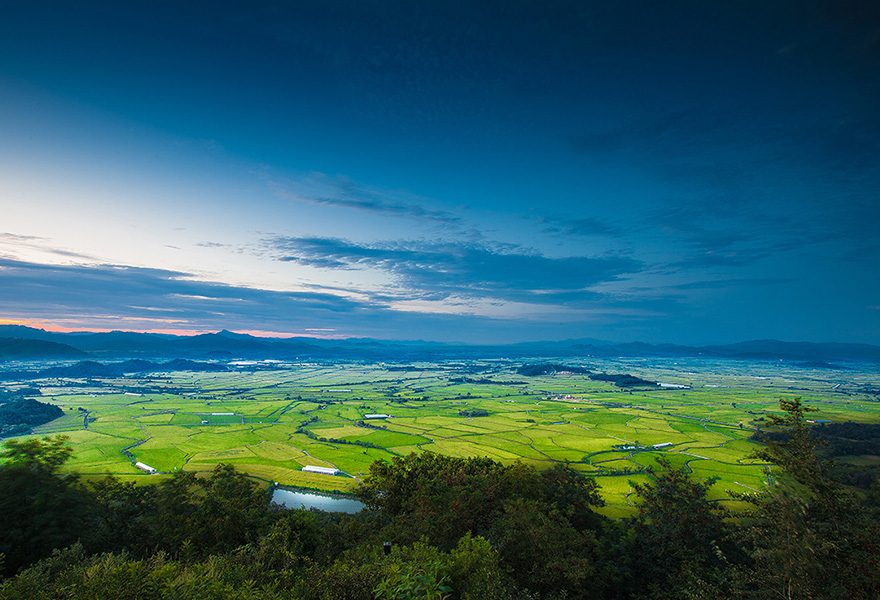
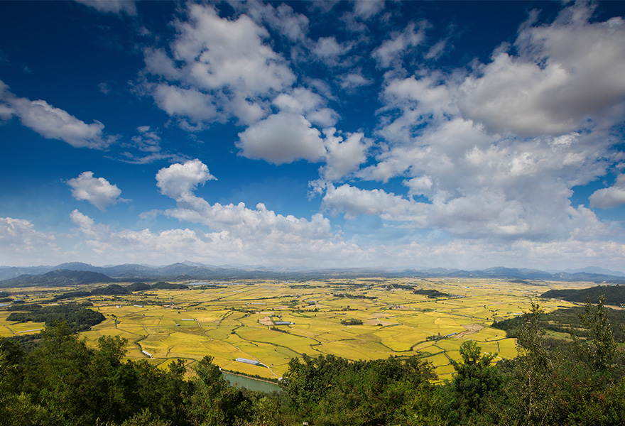
The Peace Forest, protected by the mindfiled Soisan Mountain (Lava Plateau)
262, Geumgangsan-ro, Cheorwon-eup, Cheorwon-gun
Show MapWhere did the boiling lava come from?
Cheorwon Lava Site is a volcanic topography formed by lava flowed down the valley of the fourth basalt in the Cenozoic Era. It is the only lava plateau that can be observed in the inland areas of South Korea. The formation of the basalt, which forms the Cheorwon lava site, is estimated to be between 540,000 and 120,000 years ago. This Lava Plateau was formed when lava of the basalt rose along the line, that connected the fragile point of the lower part of the Chugaryeong Tectonic Valley(Mount. Ori, 452m) and the 608-meter-high line located 4km northeast of the Gumbulang area, it spread out widely down the Cheorwon area, filling the valleys and lower parts and creating the current lava zone.
This type of volcanic eruption is called Fissure Eruption. Meanwhile, at the end of the volcanic activity, a partial eruption occurred, creating small volcanic objects such as Mount Ori and 680m highlands.
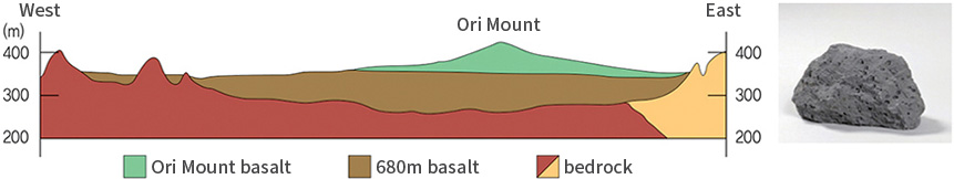 <Geological sectional view of the Cheorwon Lava Land>
At least 11 eruptions in Cheorwon Lava Plateau!
Before the formation of the Lava Plateau, Cheorwon area was composed of hilly districts, formed by the combination of the differential erosion and weathering of granite from the Mesozoic Era, and it is assumed that the Hantan River flowed smoothly between them. In the Quarternary period, basalt lava with low viscosity flowed down the Hantan River's path several times, filling the lower part with lava, forming a Lava Plateau. These lava eruptions have been repeated over and over again, and based on the 11 basalt layers observed on the rock face along the east side of Hwajiri in Cheorwon area, located in the midstream of the Hantan River, it is indicated that there have been at least 5 to 11 eruptions.
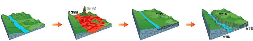 The Formation of Cheorwon Lava Plateau, Stepto, and Hantan River Valley
An island inside Cheorwon Lava Plateau?
Inside the Cheorwon Lava Land, there are several low hills located independently.
These hills are the existing mountain range which were not completely buried in the lava, but remained as islands on the lava land. when the lava filled the earths surface forming a flat Cheorwon Lava plateau,
These topography is called steptoe. Located within the Cheorwon Lava plateau, steptoes are very important for the military because of their locational advantages, and are also a place where fierce battles took place during the Korean War. The most representative one is the ice cream hill (219 meters). The name "Icecream Hill" (Hagiri, Dongsong-eup, Cheorwon-gun) was given to the mountain because it was bombed during the Korean War and the mountain flowed like a melting icecream.
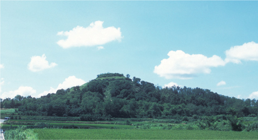 The view of the Icecream Hill
Does all volcanoes explode?
When people imagine of a "Volcanic eruption", most may think of a scene of a large volcano exploding.
This kind of scene is one of the general volcanic eruptions. Then, are all forms of volcanic eruptions the same?
Volcanic eruptions could be largely divided into two types: fissure eruption and central eruption. The central eruption is the eruption which the lava flows along a cylindrical path (magma's path). On the other hand, fissure eruption refers to the eruption of lava along a gap in the crust. It is often the result of basalt gushing out, and the coverage of the large area is caused by the eruption from several cracks.
Some examples occurred recently are the eruption of Iceland in 1783 along a 30-kilometer-long gap and the underwater eruption from the Hawaiian Islands, which was almost 500 kilometers long. The basalt in the northern part of the U.S., Oregon and its vicinity, India's Decan Plateau and Central Siberia, and in Korea, there are lava fields along the Seoul-Wonsan Line.